Aerial of Lake Athens
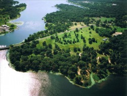
1,520-acre Lake Athens features a marina, RV resort and restaurant, as well as swimming areas and a two-lane boat ramp. Fishing and tent camping facilities are also available. Located three miles east of Athens, Lake Athens covers about 1,500 acres and is feed area creeks.
Fish species of interest to sport fisherman include: largemouth bass, crappie, white bass, redear sunfish.
LAKE ATHENS. Lake Athens, formerly known as Flat Creek Reservoir, is on Flat Creek in the Neches River basin eight miles east of Athens in Henderson County (centered at 32°12' N, 94°43' W). The project is owned and operated by the Athens Municipal Water Authority for municipal water supply, flood regulation, and recreation. Construction began on September 25, 1961, and the dam closure was made and deliberate impoundment of water started on November 1, 1962. The project was completed at the end of May 1963. The reservoir has a capacity of 32,840 acre-feet and a surface area of 1,520 acres at the spillway crest elevation of 440 feet above mean sea level. The capacity at the top of the emergency spillway at 446 feet above mean sea level is 43,000 acre-feet. The conservation storage area has been reduced to 26,990 acre-feet because of allocation of 5,850 acre-feet to dead storage space. The drainage area of Flat Creek above the dam is twenty-one square miles. The surrounding terrain is flat to rolling and is surfaced by sandy and clay loams that support water-tolerant hardwoods, conifers, and grasses.
